Satellite images of snow in Europe
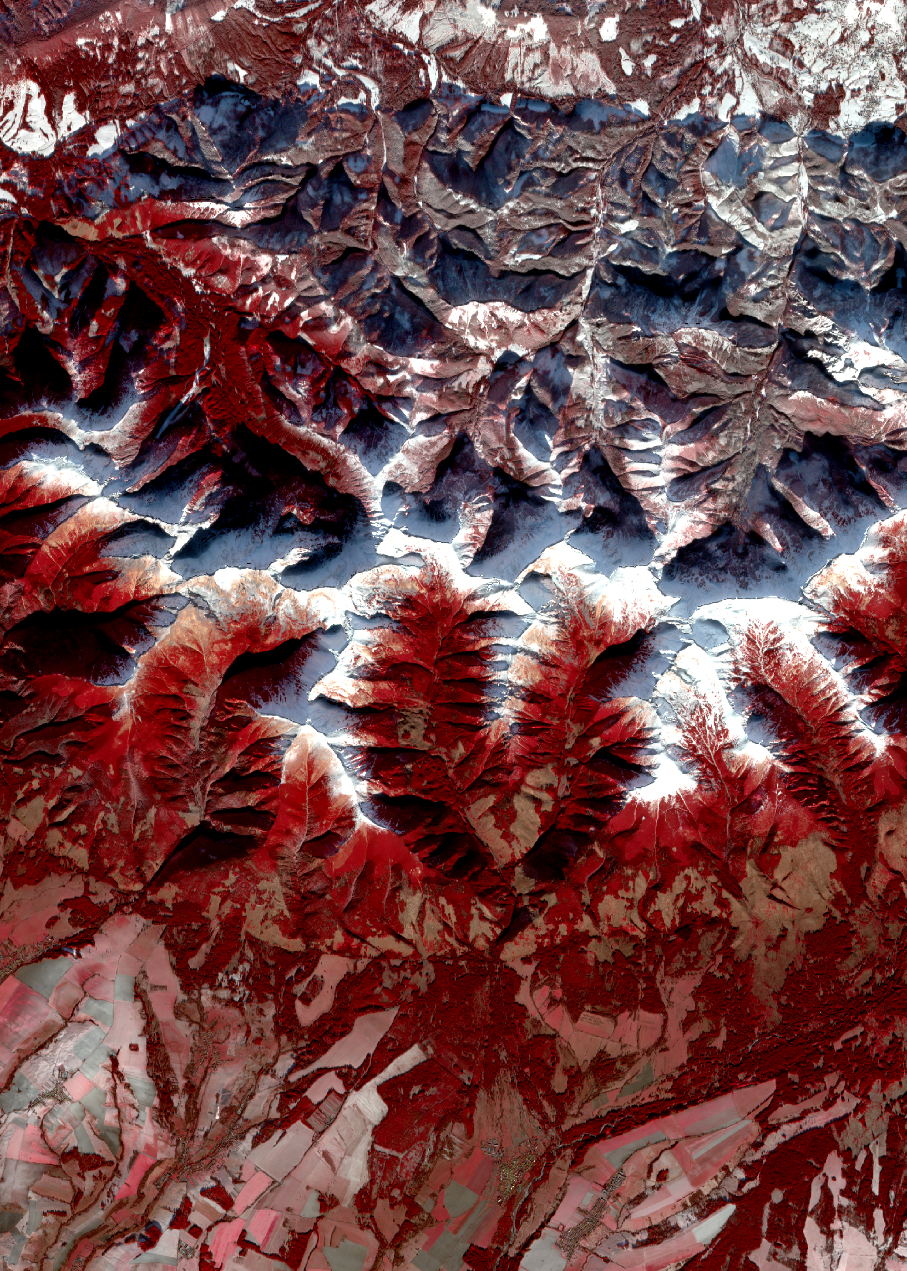
Fig. 1. The peaks of the Tatra Mountains covered with snow. Areas covered with vegetation are marked in red. Image captured by the MSI sensor of the Sentinel-2 satellite on November 29, 2018. Click the image to enlarge. (M. Krupiński/CBK PAN, based on Copernicus data)
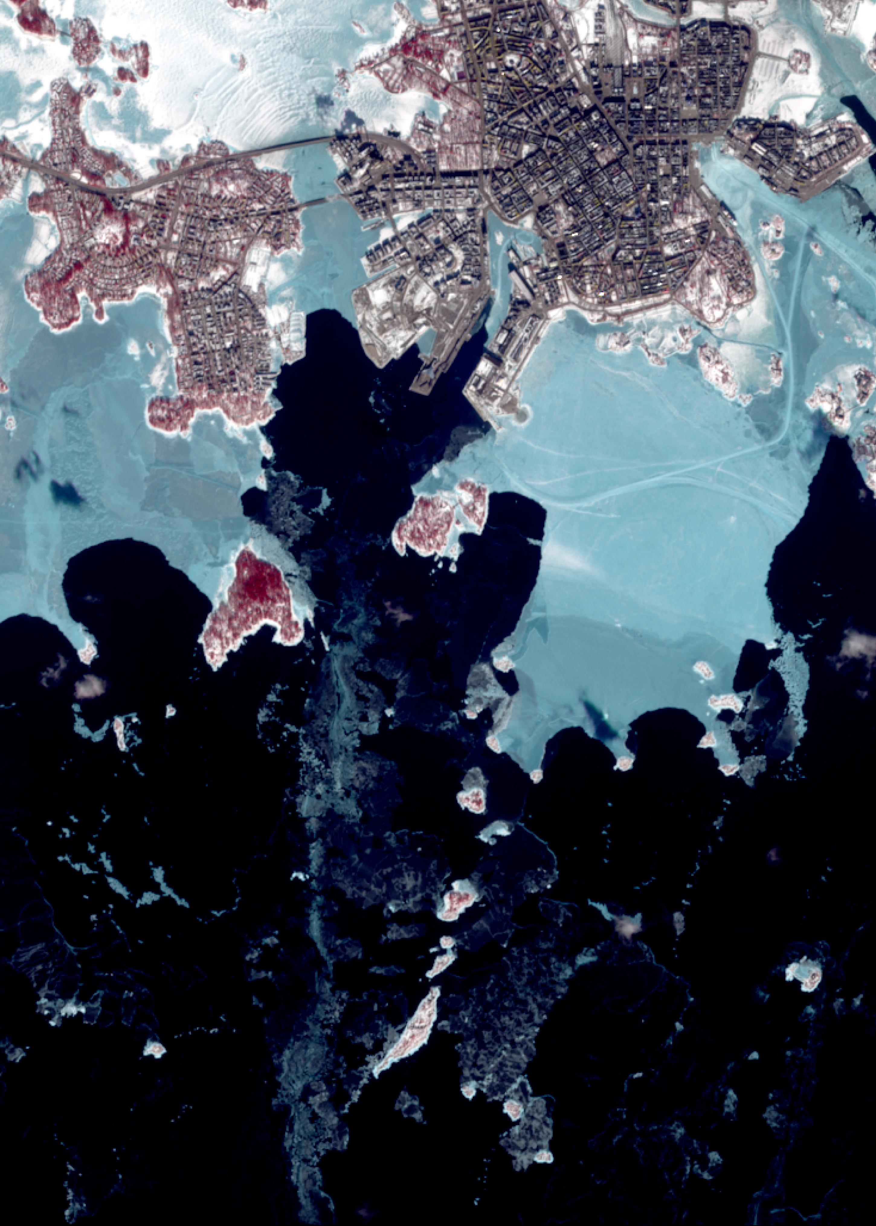
Fig. 2. Ice, shown in light blue, on the frozen surface of the Baltic Sea near Helsinki. White snow covers only part of the icy surface. Vegetation is marked in red. Image captured by the MSI sensor of the Sentinel-2 satellite on March 16, 2018. Click the image to enlarge. (M. Krupiński/CBK PAN, nbased on Copernicus data)
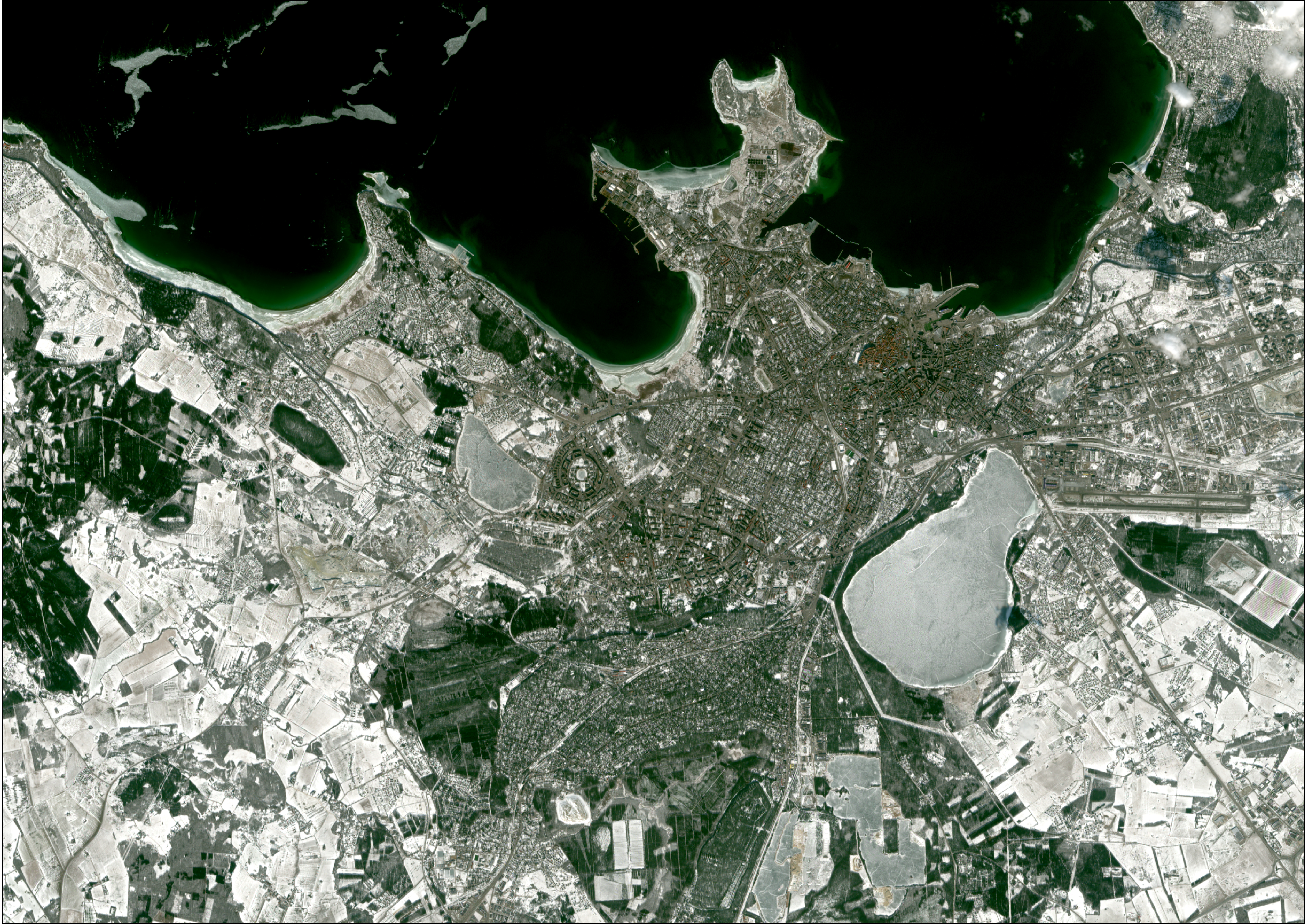
Fig. 3. Wintertime Tallinn and the Baltic Sea coastline. In the lower part of the image, the frozen Harku Lake is visible, next to the oval Väike-Õismäe residential area with a water pond in its center. Image captured by the MSI sensor of the Sentinel-2 satellite on March 16, 2018. Click the image to enlarge. (M. Krupiński/CBK PAN, based on Copernicus data)
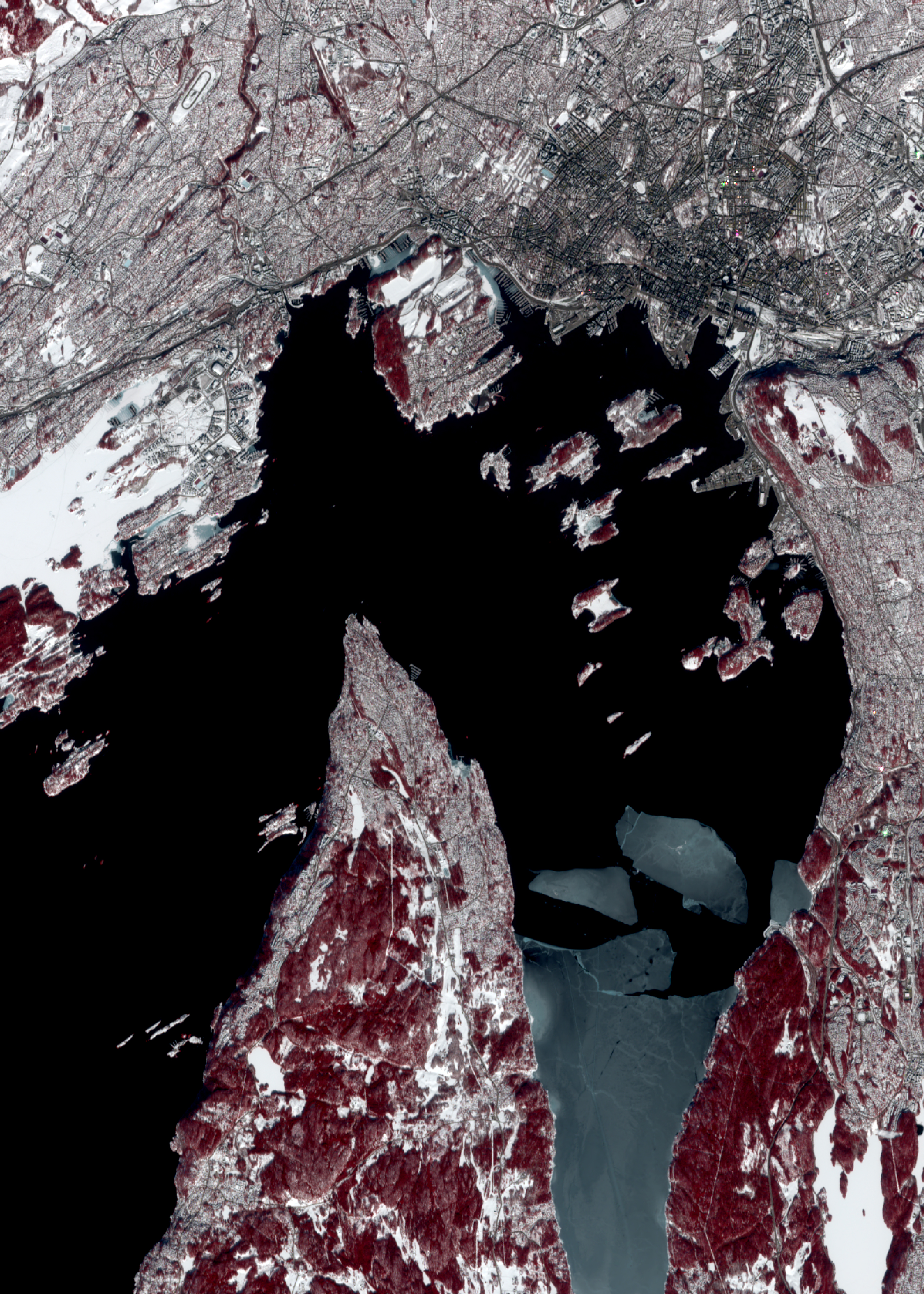
Fig. 4. Wintertime Oslo and the partially frozen Baltic Sea near the ports (shown in light blue). Vegetation is marked in red, and water surfaces are shown in black. Image captured by the MSI sensor of the Sentinel-2 satellite on March 17, 2018. Click the image to enlarge. (M. Krupiński/CBK PAN, based on Copernicus data)
Fig. 5. The frozen Lelupa River meandering along the coast flows into the unfrozen Daugava River, which in turn flows into the Baltic Sea near Riga. Ice (shown in light blue) can also be observed on the sea surface along the 25 km-long Jūrmala beach. Vegetation is marked in red. Image captured by the MSI sensor of the Sentinel-2 satellite on March 21, 2018. Click the image to enlarge. (M. Krupiński/CBK PAN, based on Copernicus data)
Fig. 6. Snow-covered mountain peaks surrounding the Lærdalselvi River valley in Norway. Vegetation in the valleys is marked in red. Image captured by the MSI sensor of the Sentinel-2 satellite on March 17, 2018. Click the image to enlarge. (M. Krupiński/CBK PAN, based on Copernicus data)
Fig. 7. Winter at the Polish-Slovakian boundary, including the Tatra Mountains region (the highest part of the Carpatians Mountains, the boundary of Poland and Slovakia). Data of ALI sensor, the EO-1 satellite, acquainted November 30, 2003. Click the image to enlarge. (A. Kotarba/CBK PAN, based on USGS data)
Fig. 8. Enlarge to see the border between snow-covered and snow-free land (snow is marked in red, clouds are white). The water body in the north part of the image is Baltic Sea, with its snow-free coast marked with shades of green. Image from ETM+ sensor of the Landsat 7 satellite, February 22, 2000. Click the image to enlarge. (A. Kotarba/CBK PAN, based on USGS data)
Fig. 9. Winter at the Polish-Slovakian. Above the snow layer only forests and buildings are seen, significantly contrasting with white background. Roads leading to Zakopane are easily seen. Image of ETM+ sensor, Landsat 7 satellite, November 29, 1999. Click the image to enlarge. (A. Kotarba/CBK PAN, based on USGS data)
Fig. 10. Snow-covered part of the Carpathians and the Sandomierz Basin on the Christmas Eve of 1999. Image of ETM+ sensor, Landsat 7 satellite. Click the image to enlarge. (A. Kotarba/CBK PAN, based on USGS data)
Fig. 11. White stripes on the Earth's surface after the snow showers in mid-February 2002. Image of ETM+ sensor, Landsat 7 satellite. Click the image to enlarge. (A. Kotarba/CBK PAN, based on USGS data)
Fig. 12. Snow-covered central part of the Vistula river valley (Poland). Image of ETM+ sensor, Landsat 7 satellite, February 28, 2001. Click the image to enlarge. (Kotarba/CBK PAN, based on USGS data)
Fig. 13. Ice floe in the Szczecin Lagoon, as seen by the ETM+ sensor of Landsat 7 satellite in mid-February, 2003. Click the image to enlarge. (A. Kotarba/CBK PAN, based on USGS data)
Fig. 14. Snow-covered estuary of Vistula river and Vistula Lagoon (note the ice floe transported by the river into Baltic Sea). Image of ETM+ sensor, Landsat 7 satellite, February 16, 2003. Click the image to enlarge. (A. Kotarba/CBK PAN, based on USGS data)
Fig. 15. Snowy landscape of Warsaw on January 8, 2003. Panchromatic image of ALI sensor on-board EO-1 satellite. Click the image to enlarge. (A. Kotarba/CBK PAN, based on USGS data)
Fig. 16. Boundary of the snow cover coincided with the course of the administrative boundary between Poland and Ukraine. Snow-free vegetated areas are in red. Image of ETM+ sensor, Landsat 7 satellite, February 19, 2000. Click the image to enlarge. (A. Kotarba/CBK PAN, based on USGS data)